Myth-Busting: Common Misconceptions About Drone Surveys and Thermal Imaging


Drone surveys and thermal imaging are transforming industries by providing innovative solutions for data collection and analysis. However, with their rise in popularity, several misconceptions have emerged, leading to confusion and misinformation. In this post, we will debunk some of the most common myths surrounding these technologies and highlight their true potential.
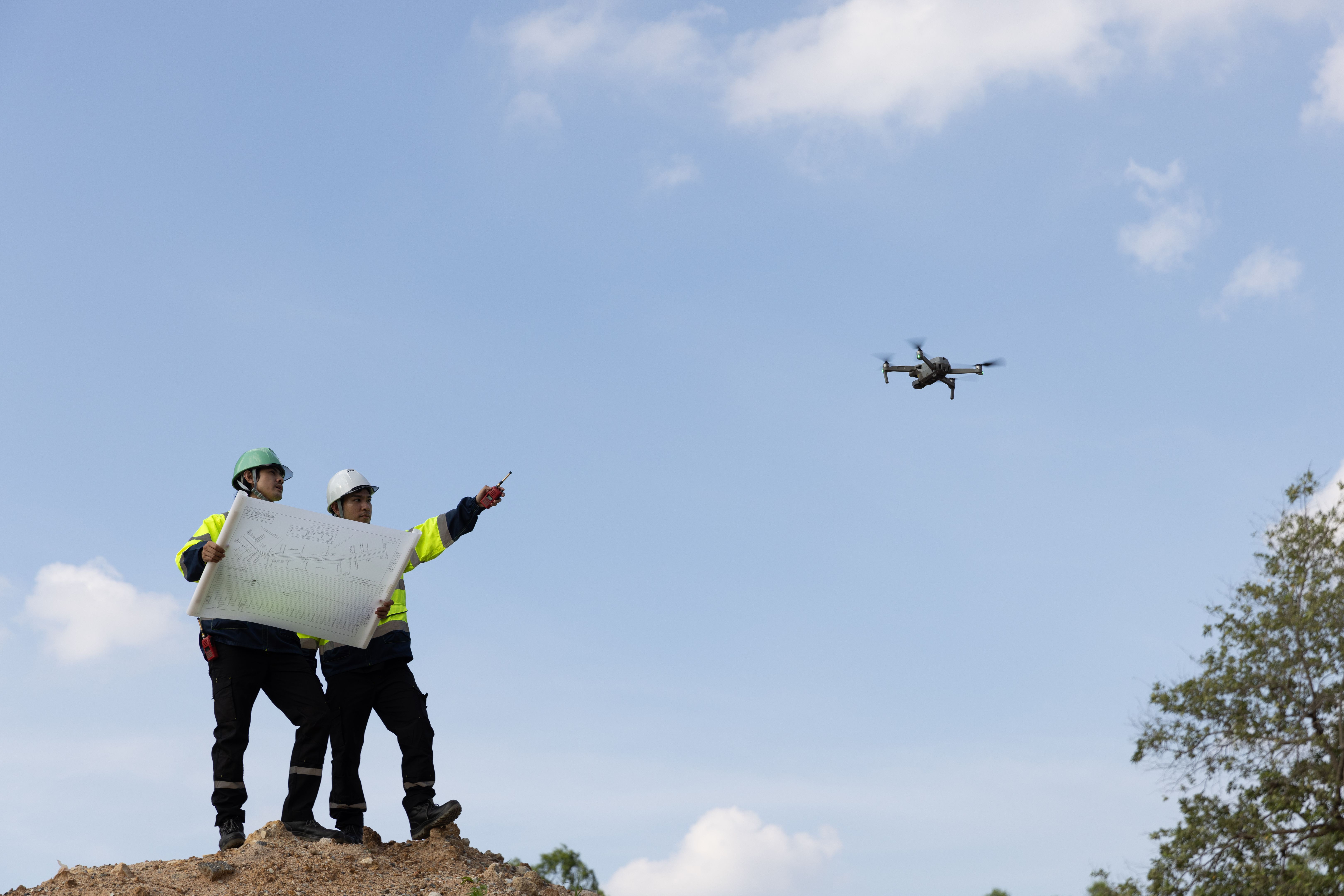
Myth 1: Drone Surveys Are Only for Aerial Photography
While drones are indeed excellent tools for capturing stunning aerial photographs, their capabilities extend far beyond this. Drones equipped with advanced sensors can collect detailed data for a variety of applications, including topographic surveys, construction monitoring, and agricultural assessments. The versatility of drones makes them invaluable in numerous fields, providing insights that traditional methods cannot match.
Applications Beyond Photography
In agriculture, drones help in crop health monitoring, irrigation management, and yield prediction by capturing multispectral images. In construction, they offer precise measurements and progress tracking, which enhance project management and efficiency. These diverse applications demonstrate that drones are much more than just flying cameras.
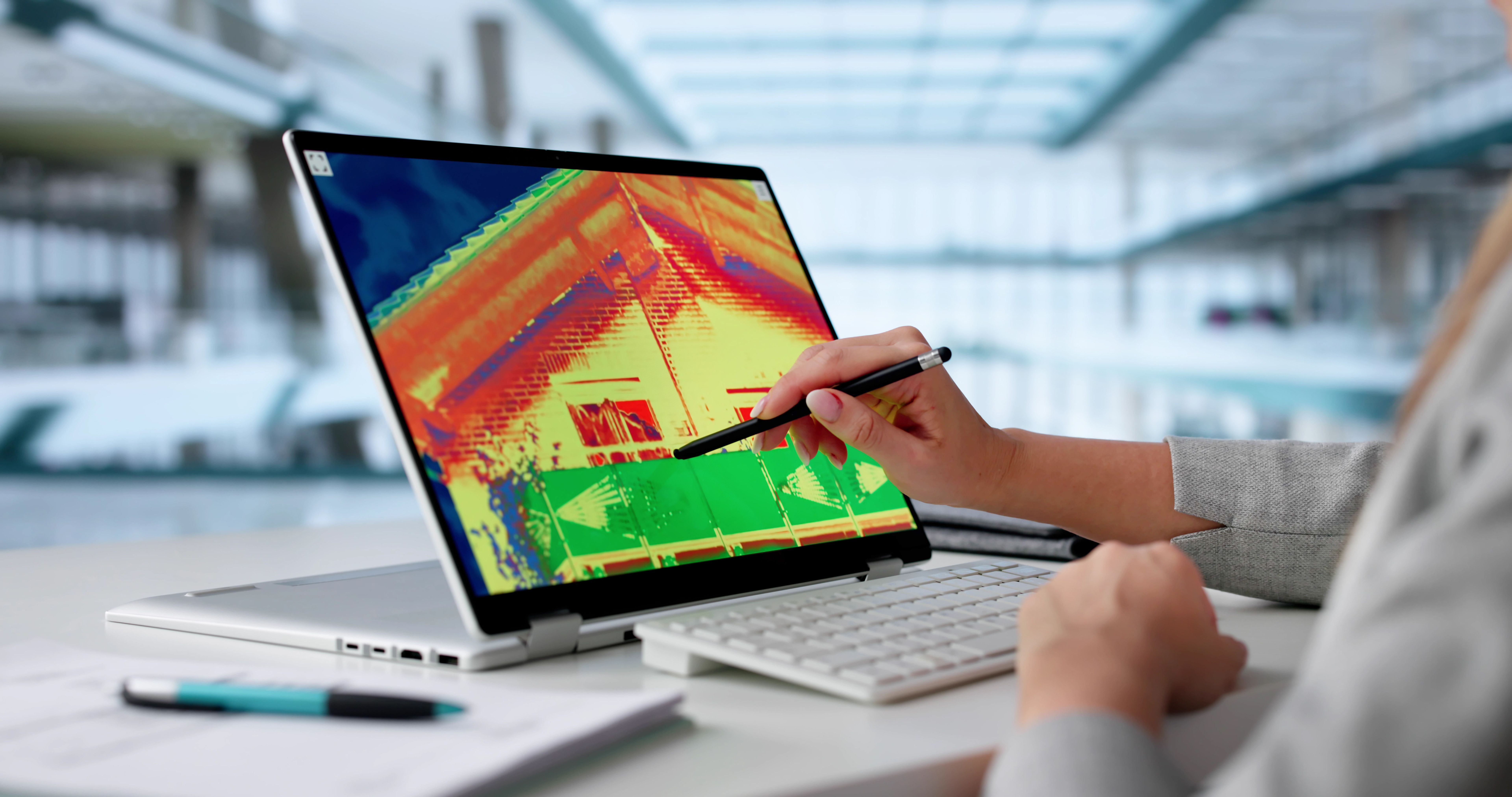
Myth 2: Thermal Imaging Is Only Useful for Detecting Heat
Thermal imaging is often associated solely with heat detection, but its capabilities are far broader. Thermal cameras detect infrared radiation, allowing them to visualize temperature differences across surfaces. This makes them incredibly useful for identifying issues that are not visible to the naked eye.
Beyond Heat Detection
In building inspections, thermal imaging can uncover hidden problems such as water leaks, structural defects, and insulation gaps. In renewable energy, it is used to monitor solar panels for defects and improve efficiency. These applications illustrate that thermal imaging is a powerful diagnostic tool across various sectors.
Myth 3: Drone Surveys and Thermal Imaging Are Expensive
Many believe that drone surveys and thermal imaging are prohibitively expensive technologies, accessible only to large corporations. In reality, the cost of these technologies has decreased significantly, making them accessible to businesses of all sizes. The investment often results in greater efficiency and cost savings over time.
Cost-Effectiveness
Drone surveys can reduce the need for manual labor and enhance safety by minimizing the time personnel spend in potentially hazardous environments. Similarly, thermal imaging can prevent costly repairs by identifying issues early. These benefits often outweigh the initial costs, providing a strong return on investment.

Myth 4: Operating Drones and Thermal Cameras Requires Extensive Expertise
Another common misconception is that these technologies are difficult to operate and require specialized skills. While some training is necessary to maximize their capabilities, modern drones and thermal cameras are designed with user-friendly interfaces and automated features that simplify operation.
User-Friendly Technologies
Many drones come with intuitive flight controls and automated flight patterns, making them accessible even to beginners. Likewise, thermal cameras often include software that simplifies data analysis. This ease of use ensures that businesses can quickly integrate these technologies into their operations.
In conclusion, drone surveys and thermal imaging are versatile, cost-effective, and user-friendly technologies that offer significant benefits across various industries. By dispelling these myths, we hope to encourage more businesses to explore and adopt these innovative solutions.